Geoportti New Frontiers RI (2025–2029)
![]()
Geoportti New Frontiers RI is a development project for strengthening the national geospatial data infrastructure.
Geoportti research infrastructure supports research using geospatial resources.
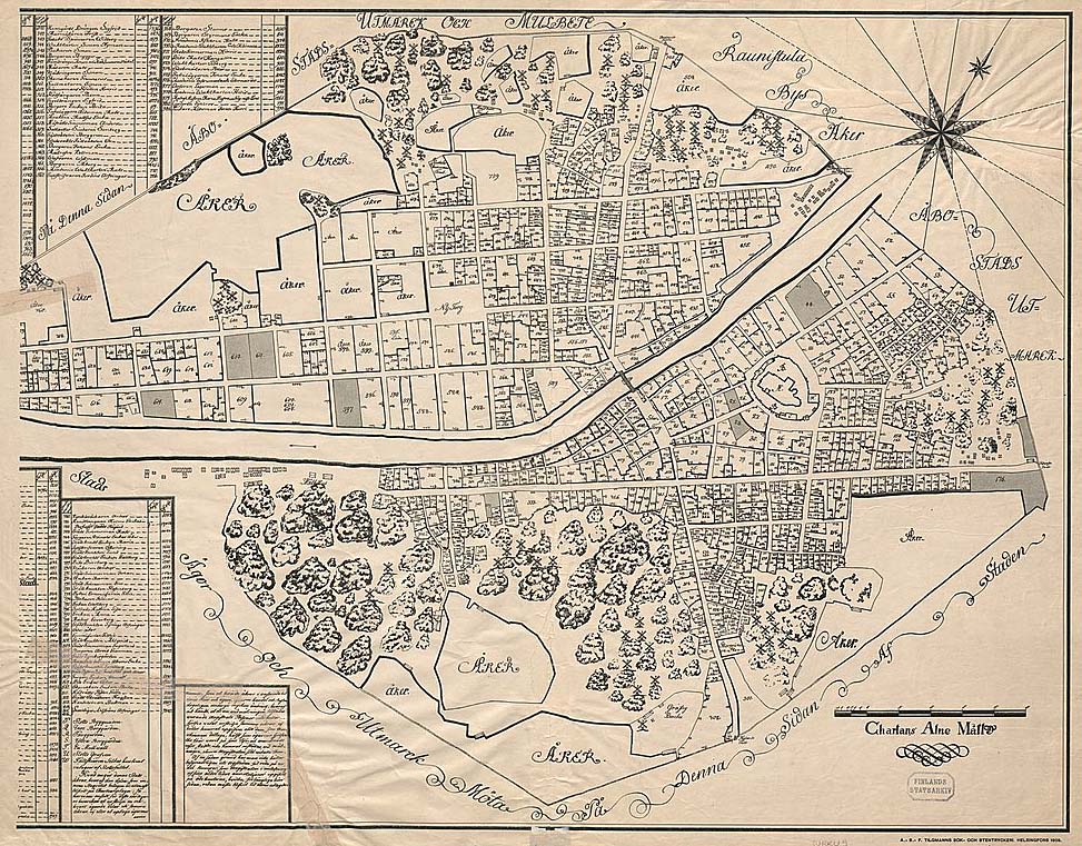
In this project, The National Archives will enhance the accessibility and usability of historical geospatial data. The main goal is to openly share georeferenced historical maps. Georeferencing binds the maps to existing location coordinates.
Additionally, the project will explore AI-based solutions in producing geospatial data from historical documents.
The project is funded by the Research Council of Finland (decision 367659).
More information
Tanja Välisalo
Research Manager,
[email protected]
Ilkka Jokipii
Head of Unit,
[email protected]